Digital terrain modeling, based on aerial photographs allows for full visualization of your interest area. In addition we offer 3D terrain model is unique in its kind, and thanks to interactivity view, requiring no special software is a handy tool for advertising and selling real estate. Interactive 3-D aerial photography - easy to spatial analysis.
Building a 3d terrain based on aerial photography is a new direction and we are the only ones among our colleagues who provide this service. Order a 3D terrain model can parallel with aerial photography and aerial photographs in addition to ready you will receive DEM.
Applications of digital elevation model (DEM):
- Prediction of the characteristics of the landscape;
- Given the nature of the relief is possible to calculate the geometric characteristics of engineering surveys, routing - navigation, architectural planning;
- Evaluation of potential risks, taking into account the characteristic osobennoyste terrain - areas of flooding at the time of floods, landslides and rock falls, etc.
- Environmental monitoring, taking into account the steepness of the slope, wind balance, brightness;
- 3D visualization for the construction of transmission lines, the design of roads, pipelines (gas, oil).
3D terrain model allows an early stage to avoid possible errors in the design and construction.
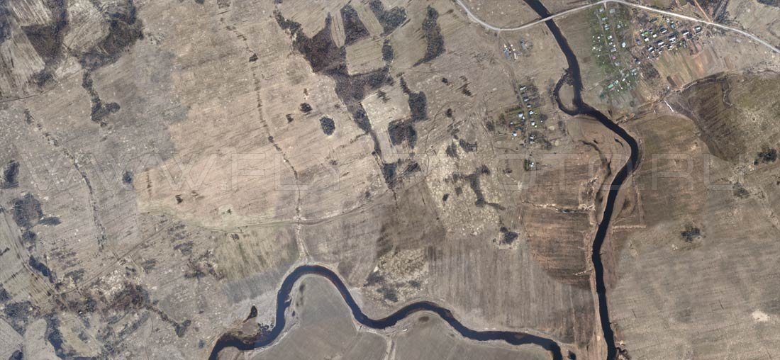
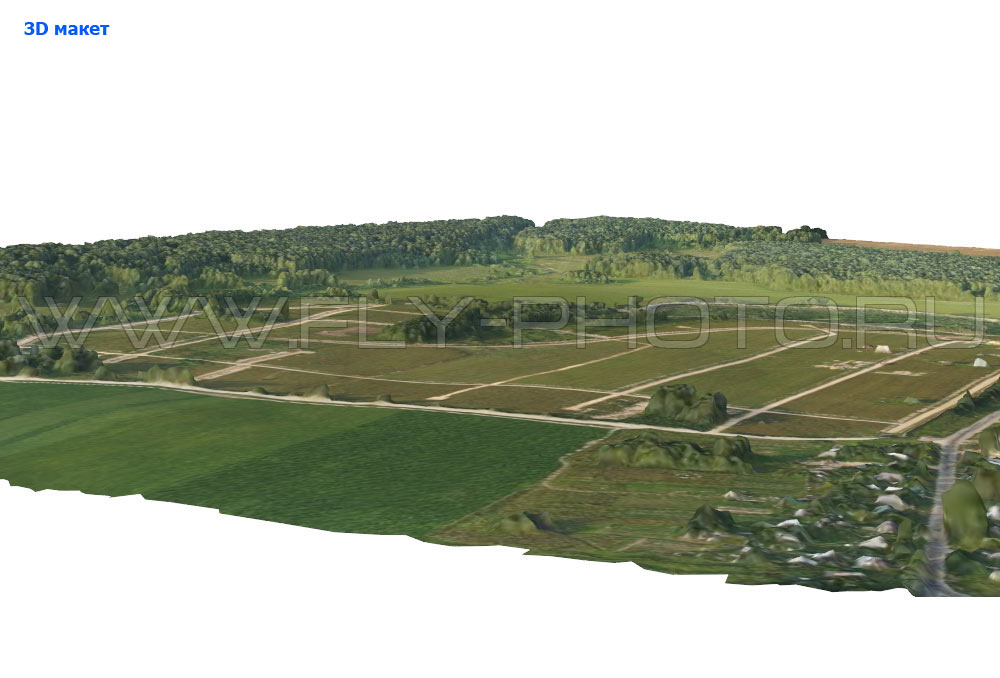
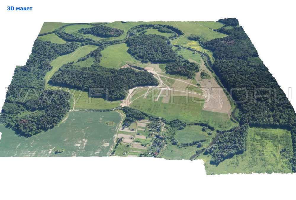
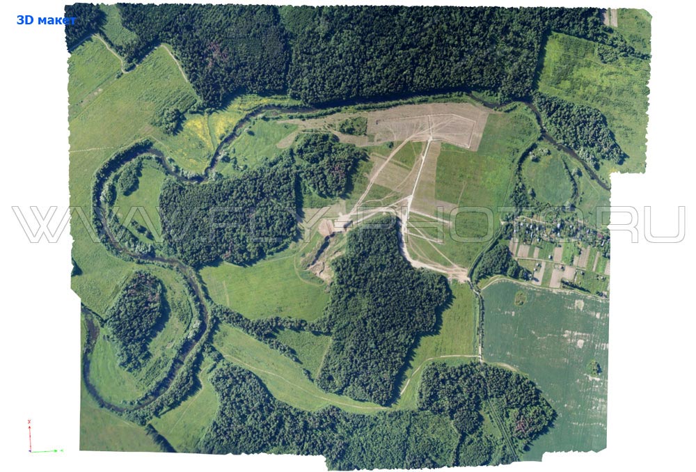
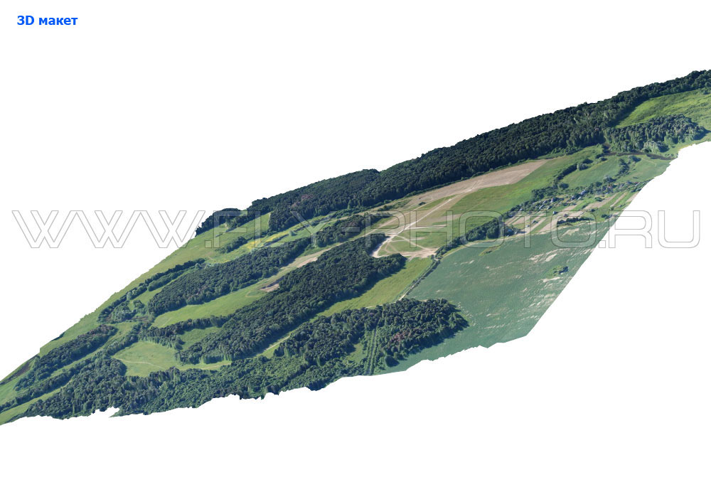
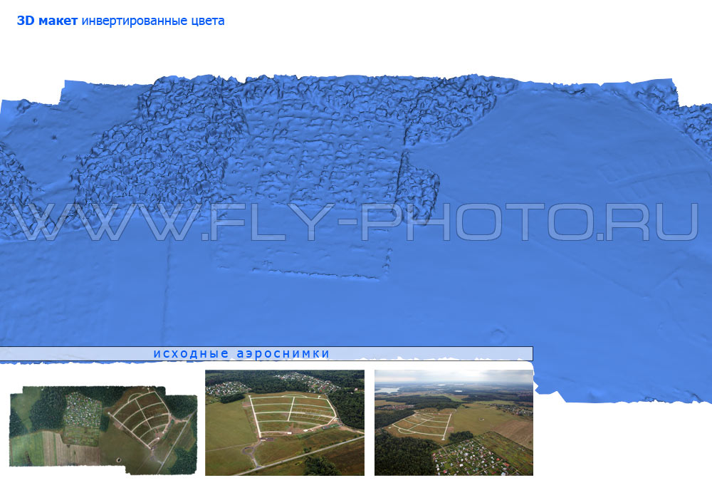
The following are examples of our three-dimensional aerial photographs and digital elevation models, in addition to the link "3D model" (right click - "save as"), you can download an interactive model of each of the sections (viewed in Acrobat Reader, is controlled by the mouse), or click on "3D model" and open it in a separate window.
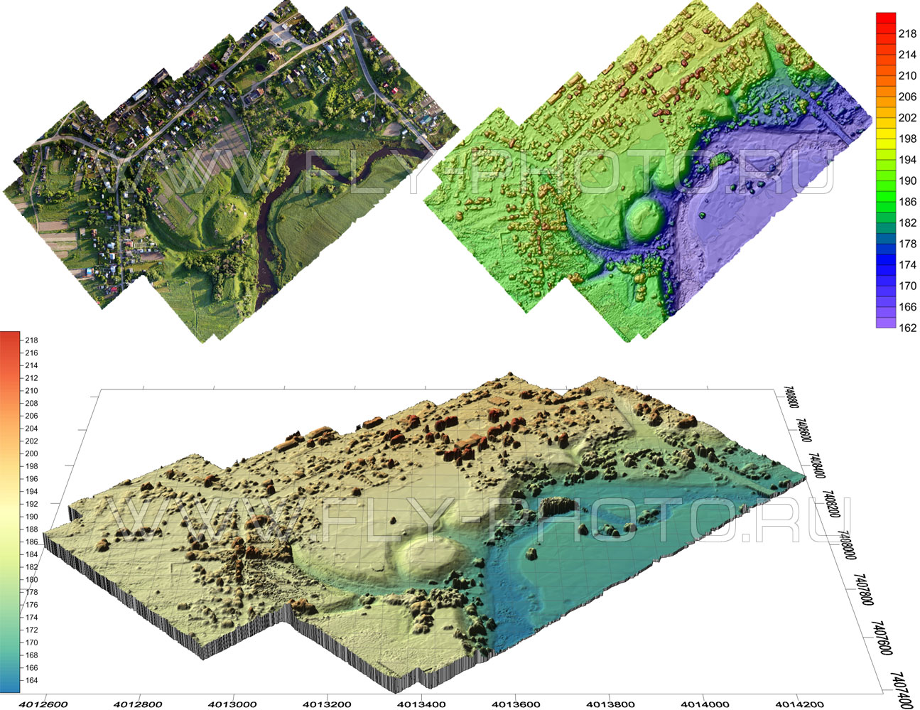
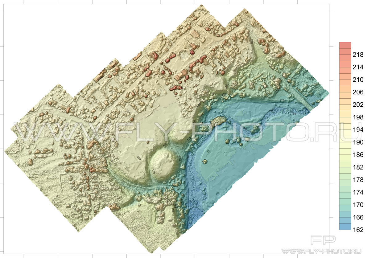
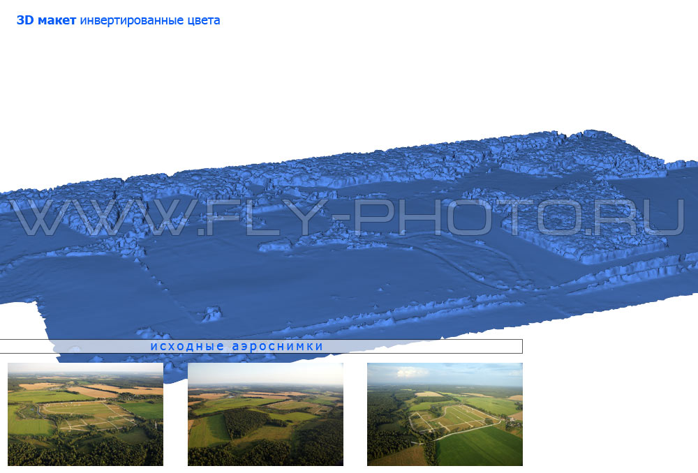
In addition to color terrain model we can provide an interactive model in inverted colors, where the "carpet" colors will distract and hide important details of the landscape: roads, ditches, ravines, areas of destruction pochny - erosion, rivers and lakes. The quality of imagery and 3D terrain model will see these bumps on the surface as mounds and bog mole hills.
 If you have any questin just wright us a message: